Garmin BaseCamp Alternatives

Garmin BaseCamp
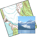
Garmin® BaseCamp® provides an interface for viewing Garmin map products and managing geographic data. With BaseCamp, you can perform the following tasks:
• Transfer data to and from your Garmin device.
• Create, view, edit, and organize waypoints, routes, and tracks.
• Find places, such as addresses, points of interest, and public land survey areas included in your detailed map data.
• View map data in 2D and 3D.
• View topographical information included in your detailed map data.
• Geotag photos with geographical location information.
• Print detailed topographical maps, PLS quads, and multi-page poster maps.
• Download and view BirdsEye™ satellite imagery and topographic raster maps.
• Import and view Garmin Custom Maps.
• Create, share and download Garmin Adventures (http://adventures.garmin.com )
Best Garmin BaseCamp Alternatives
Are you still using Garmin BaseCamp? Let's compare it to the best other options below. Maybe one of these Garmin BaseCamp alternatives will work on your device, too.

Turtle Sport
FreeOpen SourceMacWindowsLinuxTurtle Sport is an open source software developed to communicate with GPS devices : Garmin, Suunto, etc. The following functions are available: Retreive your...

QLandkarte GT
FreeOpen SourceMacWindowsLinuxQLandkarte GT is a powerful Open Source GIS application to display your GPS data on a variety of maps. It's target is the less the scientific user but the private...
Features:
- Apps with Offline Map Support
- Based on OpenStreetMap

GPXSee
FreeOpen SourceMacWindowsLinuxGPS log file viewer and analyzer with support for GPX, TCX, KML, FIT, IGC and NMEA files.

Pytrainer
FreeOpen SourceLinuxPytrainer is a tool to log all your sport excursion coming from GPS devices (with a focus on Garmin ForeRunnner 205, 305 and 405) or GPX files. Pytrainer supports GPS...

GpsPrune
FreeOpen SourceMacWindowsLinuxOpenJDKGpsPrune is an application for viewing, editing and converting coordinate data from GPS systems. Basically it's a tool to let you play with your GPS data after you...
Features:
- Android Sync
- Java

QMapShack
FreeOpen SourceMacWindowsLinuxBitbucketQMapShack is the next generation of the famous QLandkarte GT application, the GIS app to display your GPS data on a variety of maps.

Viking GPS data editor and analyzer
FreeOpen SourceMacWindowsLinuxBSDViking is a free/open source program to manage GPS data. You can import, plot and create tracks, routes and waypoints, show OSM, Terraserver, Bing Aerial and other maps...

GPSPhotoLinker
FreemiumMacGPSPhotoLinker adds GPS position and location data to your photos. The latitude and longitude recorded by your GPS unit are linked and saved to your photos....
Features:
- Geotagged Photos
- Edit metadata
ZombieTrackerGPS
FreeOpen SourceLinuxQtGPS track manager for Qt using KDE Marble maps. Currently supports GPX, TCX, and FIT format import.
Features:
- Mapping
- Training analysis
Upvote Comparison
Interest Trends
Garmin BaseCamp Reviews
Add your reviews & share your experience when using Garmin BaseCamp to the world. Your opinion will be useful to others who are looking for the best Garmin BaseCamp alternatives.