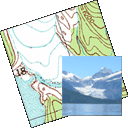
GPSPhotoLinker Alternatives

GPSPhotoLinker
GPSPhotoLinker adds GPS position and location data to your photos. The latitude and longitude recorded by your GPS unit are linked and saved to your photos. GPSPhotoLinker automatically enters the city, state and country into the metadata.
Best GPSPhotoLinker Alternatives
Are you trying to find the best programs like GPSPhotoLinker? Have a look at this post and weigh in on your thoughts. Cool!

Geosetter
FreeWindowsGeoSetter is a freeware tool for Windows for showing and changing geo data and other meta data (IPTC/XMP/Exif) of image files (e.g. images taken by digital cameras).
Features:
- Portable
- Tags

Geotag
FreeOpen SourceWindowsLinuxExifToolGeotag is an open source program that allows you match date/time information from photos with location information from a GPS unit or from a map
Features:
- Gui
- Portable

Garmin BaseCamp
FreeMacWindowsGarmin® BaseCamp® provides an interface for viewing Garmin map products and managing geographic data. With BaseCamp, you can perform the following tasks: •...

GeoTag
FreeOpen SourceMacGeoTag is a freeware tool for Mac for showing and changing geo data of image files (e.g. images taken by digital cameras).

GeoPhoto
FreeWindowsEver wondered where you took all your great photos? Or want to know where one specific photo was shot? No problem with GeoPhoto! FEATURES - View all your photos and...

TopoFusion
CommercialWindowsTopoFusion is a GPS mapping software for Windows. It downloads maps (topo, aerial photo and satellite) automatically from several public map servers.
Upvote Comparison
Interest Trends
GPSPhotoLinker Reviews
Add your reviews & share your experience when using GPSPhotoLinker to the world. Your opinion will be useful to others who are looking for the best GPSPhotoLinker alternatives.