GPSPhotoLinker Alternatives

GPSPhotoLinker
GPSPhotoLinker adds GPS position and location data to your photos. The latitude and longitude recorded by your GPS unit are linked and saved to your photos. GPSPhotoLinker automatically enters the city, state and country into the metadata.
Best Commercial GPSPhotoLinker Alternatives
Looking for the best programs similar to GPSPhotoLinker? We reviewed our top picks below. Let's see if there are any GPSPhotoLinker alternatives that work on your platform.

TopoFusion
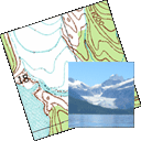
CommercialWindowsTopoFusion is a GPS mapping software for Windows. It downloads maps (topo, aerial photo and satellite) automatically from several public map servers.
GPSPhotoLinker Reviews
Add your reviews & share your experience when using GPSPhotoLinker to the world. Your opinion will be useful to others who are looking for the best GPSPhotoLinker alternatives.
Table of Contents