GeoFlow Alternatives

GeoFlow
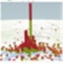
Project codename "GeoFlow" is a tool for 2013 that provides a powerful method for people to look at information in new ways enabling discoveries in data that might never be seen in traditional 2D tables and charts. GeoFlow lets you plot visually, analyze that data in 3D, and create visual tours to share with others.
GeoFlow allows users to visually plot up to a million rows of data in 3D on Bing maps, view data in a geographic space and watch change over time, and share findings through "scenes" and cinematic, guided "tours".
Best GeoFlow Alternatives for Linux
If you want similar software to GeoFlow, we have a list for that. Are there GeoFlow alternatives out there? Let's find out.

Marble
FreeOpen SourceMacWindowsLinuxPortableApps.comMarble is a Virtual Globe and World Atlas that you can use to learn more about Earth: You can pan and zoom around and you can look up places and roads. A mouse click on...
Features:
- Select map data resource
- Apps with Offline Map Support
- Portable
- Turn-by-turn Navigation

NASA World Wind
FreeOpen SourceMacWindowsLinuxWorld Wind lets you zoom from satellite altitude into any place on Earth. Leveraging Landsat satellite imagery and Shuttle Radar Topography Mission data, World Wind lets...
Features:
- Image Upscaling
- Image Navigation

Modest Maps
FreeOpen SourceMacWindowsLinuxModest Maps is a small, extensible, and free library for designers and developers who want to use interactive maps in their own projects. It provides a core set of...
Features:
- Apps with Offline Map Support
- Based on OpenStreetMap

gvSIG
FreeOpen SourceMacWindowsLinuxAndroidAndroid TabletgvSIG Mini Maps allows you to browse and navigate with GPS a full set of free on/offline maps from your phone or tablet.
Features:
- Modular System
- Apps with Offline Map Support
- Based on OpenStreetMap
- Points of interest (POI)
Upvote Comparison
Interest Trends
GeoFlow Reviews
Add your reviews & share your experience when using GeoFlow to the world. Your opinion will be useful to others who are looking for the best GeoFlow alternatives.